Weather Alert in North Carolina
Winter Storm Warning issued February 21 at 9:49PM EST until February 24 at 12:00AM EST by NWS Greenville-Spartanburg SC
AREAS AFFECTED: Avery
DESCRIPTION: * WHAT...Heavy snow expected. Total snow accumulations mostly between 2 and 6 inches, with amounts up to 10 inches possible along the Tennessee border and in the high elevations. * WHERE...Avery County. * WHEN...From midnight tonight until midnight EST Monday Night. * IMPACTS...The heavy snow will make many roads impassable and may produce a few power outages due to the weight of the snow on tree limbs and power lines. The hazardous conditions could impact the Monday morning and evening commutes. * ADDITIONAL DETAILS...Winds gusting as high as 50 mph could result in areas of blowing snow and very low visibility Sunday night and Monday.
INSTRUCTION: Monitor the latest forecasts for updates on this situation. Slow down and use caution while traveling. If you must travel, keep an extra flashlight, food, and water in your vehicle in case of an emergency. The latest road conditions for the state you are calling from can be obtained by calling 5 1 1.
Want more detail? Get the Complete 7 Day and Night Detailed Forecast!
Current U.S. National Radar--Current
The Current National Weather Radar is shown below with a UTC Time (subtract 5 hours from UTC to get Eastern Time).

National Weather Forecast--Current
The Current National Weather Forecast and National Weather Map are shown below.

National Weather Forecast for Tomorrow
Tomorrow National Weather Forecast and Tomorrow National Weather Map are show below.

North America Water Vapor (Moisture)
This map shows recent moisture content over North America. Bright and colored areas show high moisture (ie, clouds); brown indicates very little moisture present; black indicates no moisture.

Weather Topic: What are Cumulus Clouds?
Home - Education - Cloud Types - Cumulus Clouds
 Next Topic: Drizzle
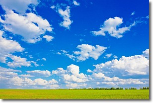
Cumulus clouds are fluffy and textured with rounded tops, and
may have flat bottoms. The border of a cumulus cloud
is clearly defined, and can have the appearance of cotton or cauliflower.
Cumulus clouds form at low altitudes (rarely above 2 km) but can grow very tall,
becoming cumulus congestus and possibly the even taller cumulonimbus clouds.
When cumulus clouds become taller, they have a greater chance of producing precipitation.
Next Topic: Drizzle
Weather Topic: What is Evaporation?
Home - Education - Precipitation - Evaporation
 Next Topic: Fog
Evaporation is the process which returns water from the earth
back to the atmosphere, and is another crucial process in the water cycle.
Evaporation is the transformation of liquid into gas, and it happens because
molecules are excited by the application of energy and turn into vapor.
In order for water to evaporate it has to be on the surface of a body of water.
Next Topic: Fog
Current conditions powered by WeatherAPI.com


