Weather Alert in Oregon
High Surf Advisory issued February 21 at 10:48PM PST until February 22 at 10:00AM PST by NWS Medford OR
AREAS AFFECTED: South Central Oregon Coast; Curry County Coast
DESCRIPTION: * WHAT...Large breaking waves of 23 to 27 feet. Surf heights are expected to reach a peak early Sunday morning. Waves will be highest on south and southwest facing beaches. * WHERE...South Central Oregon Coast and Curry County Coast. * WHEN...From 10 PM this evening to 10 AM PST Sunday. * IMPACTS...Large breaking waves will create hazardous conditions along and within the surf zone, and could inundate beaches and low lying shorelines. Beach erosion is possible, and exposed infrastructure may be damaged. * View the hazard area in detail at https://www.wrh.noaa.gov/map/?wfo=mfr
INSTRUCTION: Stay away from the surf zone and off of jetties. Area beaches may become hazardous due to dangerous surf conditions.
Want more detail? Get the Complete 7 Day and Night Detailed Forecast!
Current U.S. National Radar--Current
The Current National Weather Radar is shown below with a UTC Time (subtract 5 hours from UTC to get Eastern Time).

National Weather Forecast--Current
The Current National Weather Forecast and National Weather Map are shown below.

National Weather Forecast for Tomorrow
Tomorrow National Weather Forecast and Tomorrow National Weather Map are show below.

North America Water Vapor (Moisture)
This map shows recent moisture content over North America. Bright and colored areas show high moisture (ie, clouds); brown indicates very little moisture present; black indicates no moisture.

Weather Topic: What is Snow?
Home - Education - Precipitation - Snow
 Next Topic: Stratocumulus Clouds
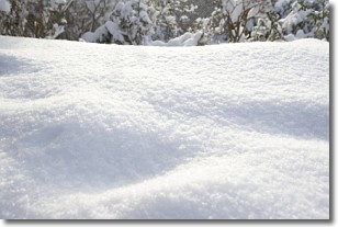
Snow is precipitation taking the form of ice crystals. Each ice crystal, or snowflake,
has unique characteristics, but all of them grow in a hexagonal structure.
Snowfall can last for sustained periods of time and result in significant buildup
of snow on the ground.
On the earth's surface, snow starts out light and powdery, but as it begins to melt
it tends to become more granular, producing small bits of ice which have the consistency of
sand. After several cycles of melting and freezing, snow can become very dense
and ice-like, commonly known as snow pack.
Next Topic: Stratocumulus Clouds
Weather Topic: What are Stratus Clouds?
Home - Education - Cloud Types - Stratus Clouds
 Next Topic: Wall Clouds
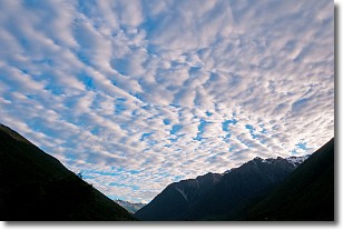
Stratus clouds are similar to altostratus clouds, but form at a
lower altitude and are identified by their fog-like appearance, lacking the
distinguishing features of most clouds.
Stratus clouds are wider than most clouds, and their base has a smooth, uniform
look which is lighter in color than a nimbostratus cloud.
The presence of a stratus cloud indicates the possibility of minor precipitation,
such as drizzle, but heavier precipitation does not typically arrive in the form
of a stratus cloud.
Next Topic: Wall Clouds
Current conditions powered by WeatherAPI.com


