Weather Alert in Kansas
Flood Warning issued March 7 at 4:50AM CST until March 10 at 5:38PM CDT by NWS Kansas City/Pleasant Hill MO
AREAS AFFECTED: Linn, KS
DESCRIPTION: ...The Flood Warning is extended for the following rivers in Kansas... Marais Des Cygnes River at La Cygne affecting Linn County. * WHAT...Minor flooding is forecast. * WHERE...Marais Des Cygnes River at La Cygne. * WHEN...From this afternoon to Tuesday afternoon. * IMPACTS...At 25.0 feet, Low lying farmland and other rural land floods. At 30.0 feet, Highway 152 floods 0.75 miles west of La Cygne. If Middle Creek is also flooding Highway 152, the only route into or out of La Cygne will be the County Road, or 4th Street, leading north from La Cygne. * ADDITIONAL DETAILS... - At 4:15 AM CST Saturday the stage was 21.5 feet. - Forecast...The river is expected to rise above flood stage this afternoon to a crest of 28.1 feet tomorrow evening. It will then fall below flood stage Monday afternoon. - Flood stage is 25.0 feet. - http://www.weather.gov/safety/flood
INSTRUCTION: Turn around, don't drown when encountering flooded roads. Most flood deaths occur in vehicles. This product along with additional weather and stream information is available at www.weather.gov/kc/.
Want more detail? Get the Complete 7 Day and Night Detailed Forecast!
Current U.S. National Radar--Current
The Current National Weather Radar is shown below with a UTC Time (subtract 5 hours from UTC to get Eastern Time).

National Weather Forecast--Current
The Current National Weather Forecast and National Weather Map are shown below.

National Weather Forecast for Tomorrow
Tomorrow National Weather Forecast and Tomorrow National Weather Map are show below.

North America Water Vapor (Moisture)
This map shows recent moisture content over North America. Bright and colored areas show high moisture (ie, clouds); brown indicates very little moisture present; black indicates no moisture.

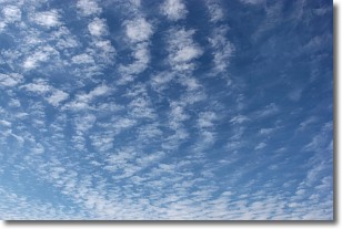
Weather Topic: What are Cirrocumulus Clouds?
Home - Education - Cloud Types - Cirrocumulus Clouds
 Next Topic: Cirrostratus Clouds
Cirrocumulus clouds form at high altitudes (usually around 5 km)
and have distinguishing characteristics displayed in a fine layer of
small cloud patches. These small cloud patches are sometimes referred to as
"cloudlets" in relation to the whole cloud formation.
Cirrocumulus clouds are formed from ice crystals and water droplets. Often, the
water droplets in the cloud freeze into ice crystals and the cloud becomes a
cirrostratus cloud. Because of this common occurrence, cirrocumulus cloud
formations generally pass rapidly.
Next Topic: Cirrostratus Clouds
Weather Topic: What are Cirrus Clouds?
Home - Education - Cloud Types - Cirrus Clouds
 Next Topic: Condensation
Cirrus clouds are high-level clouds that occur above 20,000 feet
and are composed mainly of ice crystals.
They are thin and wispy in appearance.
What do they indicate?
They are often the first sign of an approaching storm.
Next Topic: Condensation
Current conditions powered by WeatherAPI.com


