Weather Alert in Kentucky
Special Weather Statement issued February 21 at 10:59PM EST by NWS Jackson KY
AREAS AFFECTED: Fleming; Montgomery; Bath; Rowan; Estill; Powell; Menifee; Jackson; Knox; Bell; Elliott; Morgan; Johnson; Wolfe; Magoffin; Lee; Breathitt; Owsley; Clay; Leslie
DESCRIPTION: Light snow accumulations are expected at times from late Sunday morning through Monday afternoon from rounds of snow showers. Wind gusts as high as 20 to 30 mph in the heavier snow showers, combined with the falling snow, may produce sudden sharp visibility reductions and quick light snow accumulations, especially during the daytime hours on Sunday and Monday. Event total snow accumulations of one-half to around 1 inch are expected, with locally higher amounts possible where snow showers are most persistent. Temperatures during this time will range from the 20s to the lower 30s, so minor impacts to travel are possible.
INSTRUCTION: N/A
Want more detail? Get the Complete 7 Day and Night Detailed Forecast!
Current U.S. National Radar--Current
The Current National Weather Radar is shown below with a UTC Time (subtract 5 hours from UTC to get Eastern Time).

National Weather Forecast--Current
The Current National Weather Forecast and National Weather Map are shown below.

National Weather Forecast for Tomorrow
Tomorrow National Weather Forecast and Tomorrow National Weather Map are show below.

North America Water Vapor (Moisture)
This map shows recent moisture content over North America. Bright and colored areas show high moisture (ie, clouds); brown indicates very little moisture present; black indicates no moisture.

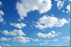
Weather Topic: What are Cumulonimbus Clouds?
Home - Education - Cloud Types - Cumulonimbus Clouds
 Next Topic: Cumulus Clouds
The final form taken by a growing cumulus cloud is the
cumulonimbus cloud, which is very tall and dense.
The tower of a cumulonimbus cloud can soar 23 km into the atmosphere, although
most commonly they stop growing at an altitude of 6 km.
Even small cumulonimbus clouds appear very large in comparison to other cloud types.
They can signal the approach of stormy weather, such as thunderstorms or blizzards.
Next Topic: Cumulus Clouds
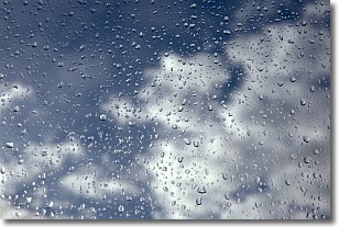
Weather Topic: What is Drizzle?
Home - Education - Precipitation - Drizzle
 Next Topic: Evaporation
Drizzle is precipitation in the form of water droplets which are
smaller than raindrops.
Drizzle is characterized by fine, gently falling droplets and typically does not
impact human habitation in a negative way. The exception to this is freezing drizzle,
a condition where drizzle freezes immediately upon reaching earth's surface.
Freezing drizzle is still less dangerous than freezing rain, but can
potentially result in hazardous road conditions.
Next Topic: Evaporation
Current conditions powered by WeatherAPI.com


