Weather Alert in Idaho
Avalanche Warning issued February 24 at 11:47AM MST by NWS Boise ID
AREAS AFFECTED: Adams, ID; Idaho, ID; Valley, ID
DESCRIPTION: The following message is transmitted at the request of the Payette National Forest Avalanche Center. ...The Payette National Forest Avalanche Center in McCall Idaho has issued a BACKCOUNTRY AVALANCHE WARNING... * WHAT...The avalanche danger for the West Central Mountains of Idaho will rise to HIGH on Tuesday afternoon and into Wednesday morning. Rain on snow and heavy, wet snow will create very dangerous avalanche conditions. * WHERE...The West Central Mountains of Idaho, including mountains near the communities of McCall, New Meadows, Donnelly, Cascade, and Yellow Pine. * WHEN...In effect from Tuesday 11:25 MST to Wednesday 11:45 MST. * IMPACTS...A warm, wet storm is bringing wet, heavy snowfall and rising rain levels up to 7000'. Natural and human-triggered avalanches large enough to bury people are very likely to occur. Even smaller steep slopes, like roadcuts, may also avalanche, depositing a surprising amount of debris on the road below.
INSTRUCTION: *Travel on or underneath slopes steeper than 30 degrees is not recommended. Avalanches may run onto groomed snowmobile trails. Pay attention to the terrain above you as conditions change and as more snow and rain fall by the afternoon. Avalanches may impact roadways along the South Fork of the Salmon, Warm Lake Summit, and East Fork South Fork. Consult WWW.PAYETTEAVALANCHE.ORG or WWW.AVALANCHE.ORG for more detailed information. Similar avalanche danger may exist at locations outside the coverage area of this or any avalanche center. LAT...LON 4491 11627 4497 11622 4488 11606 4440 11601 4429 11609 4431 11620 4439 11626 4461 11628 4468 11635 4479 11634 4485 11626
Want more detail? Get the Complete 7 Day and Night Detailed Forecast!
Current U.S. National Radar--Current
The Current National Weather Radar is shown below with a UTC Time (subtract 5 hours from UTC to get Eastern Time).

National Weather Forecast--Current
The Current National Weather Forecast and National Weather Map are shown below.

National Weather Forecast for Tomorrow
Tomorrow National Weather Forecast and Tomorrow National Weather Map are show below.

North America Water Vapor (Moisture)
This map shows recent moisture content over North America. Bright and colored areas show high moisture (ie, clouds); brown indicates very little moisture present; black indicates no moisture.

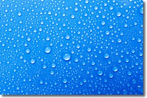
Weather Topic: What is Evaporation?
Home - Education - Precipitation - Evaporation
 Next Topic: Fog
Evaporation is the process which returns water from the earth
back to the atmosphere, and is another crucial process in the water cycle.
Evaporation is the transformation of liquid into gas, and it happens because
molecules are excited by the application of energy and turn into vapor.
In order for water to evaporate it has to be on the surface of a body of water.
Next Topic: Fog
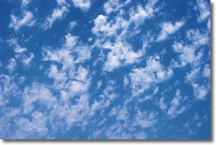
Weather Topic: What are Fractus Clouds?
Home - Education - Cloud Types - Fractus Clouds
 Next Topic: Freezing Rain
A fractus cloud (scud) is a fragmented, tattered cloud which has
likely been sheared off of another cloud. They are accessory clouds, meaning they
develop from parent clouds, and are named in a way which describes the original
cloud which contained them.
Fractus clouds which have originated from cumulus clouds are referred to as
cumulus fractus, while fractus clouds which have originated from stratus clouds
are referred to as stratus fractus. Under certain conditions a fractus cloud might
merge with another cloud, or develop into a cumulus cloud, but usually a
fractus cloud seen by itself will dissipate rapidly.
They are often observed on the leading and trailing edges of storm clouds,
and are a display of wind activity.
Next Topic: Freezing Rain
Current conditions powered by WeatherAPI.com


