Weather Alert in Connecticut
Winter Storm Warning issued February 22 at 1:03AM EST until February 23 at 7:00PM EST by NWS Albany NY
AREAS AFFECTED: Northern Litchfield; Southern Litchfield; Northern Berkshire; Southern Berkshire; Western Greene; Eastern Greene; Western Columbia; Eastern Columbia; Western Ulster; Eastern Ulster; Western Dutchess; Eastern Dutchess
DESCRIPTION: * WHAT...Heavy snow expected. Total snow accumulations between 10 and 20 inches with locally higher amounts possible in the eastern Catskills. Winds gusting as high as 45 mph will lead to widespread blowing snow and near blizzard conditions at times. * WHERE...Litchfield County in northwestern Connecticut, the Berkshires in western Massachusetts, and Ulster, Greene, Columbia and Dutchess Counties in eastern New York. * WHEN...From 1 PM this afternoon to 7 PM EST Monday. * IMPACTS...Travel could be difficult to impossible. The hazardous conditions will impact the Monday morning and evening commutes. Gusty winds could bring down tree branches and lead to power outages. * ADDITIONAL DETAILS...A powerful nor'easter will impact the region late this afternoon through Monday. The higher snowfall amounts will be favored across the higher elevations. Snowfall rates may reach 2 inches per hour at times tonight into early Monday morning.
INSTRUCTION: If you must travel, keep an extra flashlight, food, and water in your vehicle in case of an emergency.
Want more detail? Get the Complete 7 Day and Night Detailed Forecast!
Current U.S. National Radar--Current
The Current National Weather Radar is shown below with a UTC Time (subtract 5 hours from UTC to get Eastern Time).

National Weather Forecast--Current
The Current National Weather Forecast and National Weather Map are shown below.

National Weather Forecast for Tomorrow
Tomorrow National Weather Forecast and Tomorrow National Weather Map are show below.

North America Water Vapor (Moisture)
This map shows recent moisture content over North America. Bright and colored areas show high moisture (ie, clouds); brown indicates very little moisture present; black indicates no moisture.

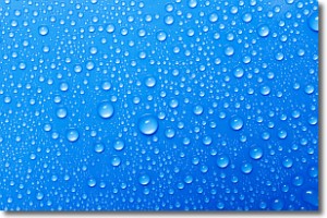
Weather Topic: What is Condensation?
Home - Education - Precipitation - Condensation
 Next Topic: Contrails
Condensation is the process which creates clouds, and therefore
it is a crucial process in the water cycle.
Condensation is the change of matter from a state of gas into a state of liquid,
and it happens because water molecules release heat into the atmosphere and
become organized into a more closely packed structure, what we might see as
water droplets.
Water is always present in the air around us as a vapor, but it's too small for
us to see. When water undergoes the process of condensation it becomes organized
into visible water droplets. You've probably seen condensation happen before on the
surface of a cold drink!
Next Topic: Contrails
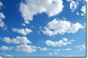
Weather Topic: What are Cumulonimbus Clouds?
Home - Education - Cloud Types - Cumulonimbus Clouds
 Next Topic: Cumulus Clouds
The final form taken by a growing cumulus cloud is the
cumulonimbus cloud, which is very tall and dense.
The tower of a cumulonimbus cloud can soar 23 km into the atmosphere, although
most commonly they stop growing at an altitude of 6 km.
Even small cumulonimbus clouds appear very large in comparison to other cloud types.
They can signal the approach of stormy weather, such as thunderstorms or blizzards.
Next Topic: Cumulus Clouds
Current conditions powered by WeatherAPI.com


