Weather Alert in Montana
Avalanche Warning issued February 23 at 6:44PM MST by NWS Missoula MT
AREAS AFFECTED: Kootenai/Cabinet Region
DESCRIPTION: AVWMSO The following message is transmitted at the request of Idaho Panhandle Avalanche Center Sandpoint ID. ...AVALANCHE WARNING ISSUED BY THE IDAHO PANHANDLE AVALANCHE CENTER... 16:00 PST Mon Feb 23 2026 The Idaho Panhandle Avalanche Center in Sandpoint has issued a BACKCOUNTRY AVALANCHE WARNING for the following areas: NWS Missoula MT - MTZ001 (MTZ001) NWS Spokane WA - ID 017 (Bonner County)...ID 021 (Boundary County)...ID 079 (Shoshone County) * WHAT...An Avalanche Warning is in effect from Monday 4 PM to Tuesday 4 PM. Very dangerous avalanche conditions have developed from heavy snowfall and strong winds, and will last through Tuesday. You can very easily trigger avalanches large enough to bury or kill you, and some will release spontaneously. Avoid travel in avalanche terrain during this period. * WHERE...The Selkirk Mountains, West and East Cabinet Mountains, Purcell Mountains, and the Bitterroot Mountains - Silver Valley above 4,000 feet. * WHEN...In effect from Mon 16:00 PST to Tue 16:00 PST. * IMPACTS...Dense snowfall and widespread drifting has formed dangerous slabs of snow over multiple fragile weak snow layers. The new snow is adding enough stress to the snowpack to cause a widespread cycle of avalanches large enough to bury, injure, or kill a person. Some of these avalanches could propagate widely across terrain features like ridges, and run long distances into mature forests, valley floors, or flat terrain. It will be very easy for backcountry travelers to trigger them. * PRECAUTIONARY / PREPAREDNESS ACTIONS...Travel in and around avalanche terrain is not recommended during this period. Consult http://www.idahopanhandleavalanche.org/ or www.avalanche.org for more detailed information. Similar avalanche danger may exist at locations outside the coverage area of this or any avalanche center.
INSTRUCTION: N/A
Want more detail? Get the Complete 7 Day and Night Detailed Forecast!
Current U.S. National Radar--Current
The Current National Weather Radar is shown below with a UTC Time (subtract 5 hours from UTC to get Eastern Time).

National Weather Forecast--Current
The Current National Weather Forecast and National Weather Map are shown below.

National Weather Forecast for Tomorrow
Tomorrow National Weather Forecast and Tomorrow National Weather Map are show below.

North America Water Vapor (Moisture)
This map shows recent moisture content over North America. Bright and colored areas show high moisture (ie, clouds); brown indicates very little moisture present; black indicates no moisture.

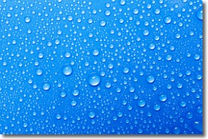
Weather Topic: What is Evaporation?
Home - Education - Precipitation - Evaporation
 Next Topic: Fog
Evaporation is the process which returns water from the earth
back to the atmosphere, and is another crucial process in the water cycle.
Evaporation is the transformation of liquid into gas, and it happens because
molecules are excited by the application of energy and turn into vapor.
In order for water to evaporate it has to be on the surface of a body of water.
Next Topic: Fog
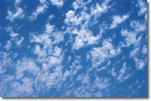
Weather Topic: What are Fractus Clouds?
Home - Education - Cloud Types - Fractus Clouds
 Next Topic: Freezing Rain
A fractus cloud (scud) is a fragmented, tattered cloud which has
likely been sheared off of another cloud. They are accessory clouds, meaning they
develop from parent clouds, and are named in a way which describes the original
cloud which contained them.
Fractus clouds which have originated from cumulus clouds are referred to as
cumulus fractus, while fractus clouds which have originated from stratus clouds
are referred to as stratus fractus. Under certain conditions a fractus cloud might
merge with another cloud, or develop into a cumulus cloud, but usually a
fractus cloud seen by itself will dissipate rapidly.
They are often observed on the leading and trailing edges of storm clouds,
and are a display of wind activity.
Next Topic: Freezing Rain
Current conditions powered by WeatherAPI.com


