Weather Alert in Georgia
Flood Warning issued February 27 at 6:48AM EST until February 28 at 7:00PM EST by NWS Peachtree City GA
AREAS AFFECTED: Forsyth, GA; Fulton, GA
DESCRIPTION: ...The National Weather Service in Peachtree City GA has issued a Flood Warning for the following rivers in Georgia... Big Creek near Alpharetta affecting Fulton and Forsyth Counties. * WHAT...Minor flooding is occurring. * WHERE...Big Creek near Alpharetta. * WHEN...Until Saturday evening. * IMPACTS...At 8.0 feet, Minor flooding continues to expand further into the woodlands and fields along the creek from near Cumming in south Forsyth County to Alpharetta and Roswell in north Fulton County. Additional portions of The Big Creek Greenway have minor flooding with 1 to 2 feet of water. Most of the walking and biking paths will be closed...especially upstream and downstream from the gage on Kimball Bridge Road and near Rock Mill Park. Portions of the YMCA Campground off Preston Ridge Road will flood. * ADDITIONAL DETAILS... - At 6:30 AM EST Friday the stage was 7.0 feet. - Recent Activity...The maximum river stage in the 24 hours ending at 6:30 AM EST Friday was 7.0 feet. - Forecast...The river is expected to rise to a crest of 7.7 feet this evening. It will then fall below flood stage by Saturday evening. - Flood stage is 7.0 feet. - Flood History...This crest compares to a previous crest of 7.7 feet on 02/14/2020. - http://www.weather.gov/safety/flood
INSTRUCTION: Turn around, don't drown when encountering flooded roads. Most flood deaths occur in vehicles. Additional information is available at weather.gov/atlanta.
Want more detail? Get the Complete 7 Day and Night Detailed Forecast!
Current U.S. National Radar--Current
The Current National Weather Radar is shown below with a UTC Time (subtract 5 hours from UTC to get Eastern Time).

National Weather Forecast--Current
The Current National Weather Forecast and National Weather Map are shown below.

National Weather Forecast for Tomorrow
Tomorrow National Weather Forecast and Tomorrow National Weather Map are show below.

North America Water Vapor (Moisture)
This map shows recent moisture content over North America. Bright and colored areas show high moisture (ie, clouds); brown indicates very little moisture present; black indicates no moisture.

Weather Topic: What is Drizzle?
Home - Education - Precipitation - Drizzle
 Next Topic: Evaporation
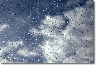
Drizzle is precipitation in the form of water droplets which are
smaller than raindrops.
Drizzle is characterized by fine, gently falling droplets and typically does not
impact human habitation in a negative way. The exception to this is freezing drizzle,
a condition where drizzle freezes immediately upon reaching earth's surface.
Freezing drizzle is still less dangerous than freezing rain, but can
potentially result in hazardous road conditions.
Next Topic: Evaporation
Weather Topic: What is Fog?
Home - Education - Cloud Types - Fog
 Next Topic: Fractus Clouds
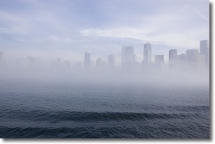
Fog is technically a type of stratus cloud, which lies along the
ground and obscures visibility.
It is usually created when humidity in the air condenses into tiny water droplets.
Because of this, some places are more prone to foggy weather, such as regions
close to a body of water.
Fog is similar to mist; both are the appearance of water droplets suspended in
the air, but fog is the term applied to the condition when visibility is less than 1 km.
Next Topic: Fractus Clouds
Current conditions powered by WeatherAPI.com


