Weather Alert in Iowa
Winter Weather Advisory issued February 27 at 2:25AM CST until February 28 at 6:00PM CST by NWS La Crosse WI
AREAS AFFECTED: Howard; Winneshiek; Allamakee; Dodge; Olmsted; Mower; Fillmore; Houston; Vernon; Crawford; Richland
DESCRIPTION: ...BAND OF HEAVY SNOW SATURDAY... .A narrow band of heavy snow with 1" to 2" per hour snowfall rates likely develops over the Upper Mississippi River Valley Saturday morning into the evening. Heaviest snowfall rates and subsequent amounts will sharply decrease on either side of the band. Therefore, any small change to storm track greatly affects impacts and amounts locally. Current confidence in accumulating snowfall is highest from the Minnesota and Iowa border into western Wisconsin at this time. Longer duration of heavier snowfall may also result in higher amounts. * WHAT...Snow expected. Heavier snowfall rates causing temporary visibility reductions. Total snow accumulations between 1 and 4 inches. * WHERE...Portions of northeast Iowa, southeast Minnesota, and southwest Wisconsin. * WHEN...From 6 AM to 6 PM CST Saturday. * IMPACTS...Plan on slippery road conditions.
INSTRUCTION: Slow down and use caution while traveling. In Iowa, visit 511ia.org for road conditions. In Minnesota, visit 511mn.org for road conditions. In Wisconsin, visit 511wi.gov for road conditions.
Want more detail? Get the Complete 7 Day and Night Detailed Forecast!
Current U.S. National Radar--Current
The Current National Weather Radar is shown below with a UTC Time (subtract 5 hours from UTC to get Eastern Time).

National Weather Forecast--Current
The Current National Weather Forecast and National Weather Map are shown below.

National Weather Forecast for Tomorrow
Tomorrow National Weather Forecast and Tomorrow National Weather Map are show below.

North America Water Vapor (Moisture)
This map shows recent moisture content over North America. Bright and colored areas show high moisture (ie, clouds); brown indicates very little moisture present; black indicates no moisture.

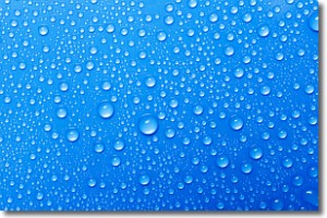
Weather Topic: What is Evaporation?
Home - Education - Precipitation - Evaporation
 Next Topic: Fog
Evaporation is the process which returns water from the earth
back to the atmosphere, and is another crucial process in the water cycle.
Evaporation is the transformation of liquid into gas, and it happens because
molecules are excited by the application of energy and turn into vapor.
In order for water to evaporate it has to be on the surface of a body of water.
Next Topic: Fog
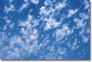
Weather Topic: What are Fractus Clouds?
Home - Education - Cloud Types - Fractus Clouds
 Next Topic: Freezing Rain
A fractus cloud (scud) is a fragmented, tattered cloud which has
likely been sheared off of another cloud. They are accessory clouds, meaning they
develop from parent clouds, and are named in a way which describes the original
cloud which contained them.
Fractus clouds which have originated from cumulus clouds are referred to as
cumulus fractus, while fractus clouds which have originated from stratus clouds
are referred to as stratus fractus. Under certain conditions a fractus cloud might
merge with another cloud, or develop into a cumulus cloud, but usually a
fractus cloud seen by itself will dissipate rapidly.
They are often observed on the leading and trailing edges of storm clouds,
and are a display of wind activity.
Next Topic: Freezing Rain
Current conditions powered by WeatherAPI.com


