Weather Alert in Alaska
Winter Weather Advisory issued March 3 at 2:52PM AKST until March 4 at 12:00PM AKST by NWS Juneau AK
AREAS AFFECTED: City and Borough of Yakutat
DESCRIPTION: ...SNOW FOR THE NORTHERN AND CENTRAL PANHANDLE THROUGH WEDNESDAY... The next surge of snow is expected this evening as the main low moves closer to the panhandle bringing more moisture to the area. This next surge of moisture is expected to bring increasing snowfall rates to the Icy Strait corridor this evening. Along with this second wave of snow, the original band of snow is expected to set up around the Yakutat area bringing more accumulating snow to the area with the heaviest parts to the west of Yakutat. * WHAT...Snow expected. Total snow accumulations of 6 to 9 inches. * WHERE...City and Borough of Yakutat. * WHEN...Until noon AKST Wednesday. * IMPACTS...Travel could be very difficult. * ADDITIONAL DETAILS...Snowfall amounts could be higher if the heaviest snow band, which is currently projected to set up west of Yakutat, moves further east.
INSTRUCTION: Slow down and use caution while traveling. People are urged to prepare their property before the onset of winter weather. For the latest road conditions, where available, call 5 1 1 or visit 511.alaska.gov.
Want more detail? Get the Complete 7 Day and Night Detailed Forecast!
Current U.S. National Radar--Current
The Current National Weather Radar is shown below with a UTC Time (subtract 5 hours from UTC to get Eastern Time).

National Weather Forecast--Current
The Current National Weather Forecast and National Weather Map are shown below.

National Weather Forecast for Tomorrow
Tomorrow National Weather Forecast and Tomorrow National Weather Map are show below.

North America Water Vapor (Moisture)
This map shows recent moisture content over North America. Bright and colored areas show high moisture (ie, clouds); brown indicates very little moisture present; black indicates no moisture.

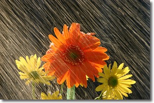
Weather Topic: What is Rain?
Home - Education - Precipitation - Rain
 Next Topic: Shelf Clouds
Precipitation in the form of water droplets is called rain.
Rain generally has a tendency to fall with less intensity over a greater period
of time, and when rainfall is more severe it is usually less sustained.
Rain is the most common form of precipitation and happens with greater frequency
depending on the season and regional influences. Cities have been shown to have
an observable effect on rainfall, due to an effect called the urban heat island.
Compared to upwind, monthly rainfall between twenty and forty miles downwind of
cities is 30% greater.
Next Topic: Shelf Clouds
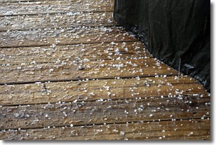
Weather Topic: What is Sleet?
Home - Education - Precipitation - Sleet
 Next Topic: Snow
Sleet is a form of precipitation in which small ice pellets are the primary
components. These ice pellets are smaller and more translucent than hailstones,
and harder than graupel. Sleet is caused by specific atmospheric conditions and
therefore typically doesn't last for extended periods of time.
The condition which leads to sleet formation requires a warmer body of air to be
wedged in between two sub-freezing bodies of air. When snow falls through a warmer
layer of air it melts, and as it falls through the next sub-freezing body of air
it freezes again, forming ice pellets known as sleet. In some cases, water
droplets don't have time to freeze before reaching the surface and the result is
freezing rain.
Next Topic: Snow
Current conditions powered by WeatherAPI.com


