Weather Alert in Hawaii
Winter Weather Advisory issued February 21 at 3:22PM HST until February 22 at 6:00AM HST by NWS Honolulu HI
AREAS AFFECTED: Big Island Summit
DESCRIPTION: ...WINTER WEATHER ADVISORY IN EFFECT UNTIL 6 AM HST SUNDAY FOR THE BIG ISLAND SUMMITS ABOVE 12,000 FEET... .An upper level disturbance will continue to bring periods of light snow, freezing drizzle and freezing fog across the summits of Mauna Loa and Mauna Kea on the Big Island through tonight. Snow showers should generally be on the decrease tonight, but slick conditions could very well continue through the morning hours. * WHAT...Snow, freezing fog and freezing drizzle. Up to 2 inches of snowfall along with a wintry mix of icing is possible. * WHERE...Big Island Summits. * WHEN...Until 6 AM HST Sunday. * IMPACTS...Travel could be very difficult. Freezing fog will significantly reduce visibility at times, with periods of zero visibility.
INSTRUCTION: A Winter Weather Advisory means that periods of snow, sleet, or freezing rain will cause travel difficulties. Be prepared for slippery roads and limited visibilities and use caution while driving.
Want more detail? Get the Complete 7 Day and Night Detailed Forecast!
Current U.S. National Radar--Current
The Current National Weather Radar is shown below with a UTC Time (subtract 5 hours from UTC to get Eastern Time).

National Weather Forecast--Current
The Current National Weather Forecast and National Weather Map are shown below.

National Weather Forecast for Tomorrow
Tomorrow National Weather Forecast and Tomorrow National Weather Map are show below.

North America Water Vapor (Moisture)
This map shows recent moisture content over North America. Bright and colored areas show high moisture (ie, clouds); brown indicates very little moisture present; black indicates no moisture.

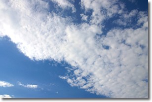
Weather Topic: What are Stratus Clouds?
Home - Education - Cloud Types - Stratus Clouds
 Next Topic: Wall Clouds
Stratus clouds are similar to altostratus clouds, but form at a
lower altitude and are identified by their fog-like appearance, lacking the
distinguishing features of most clouds.
Stratus clouds are wider than most clouds, and their base has a smooth, uniform
look which is lighter in color than a nimbostratus cloud.
The presence of a stratus cloud indicates the possibility of minor precipitation,
such as drizzle, but heavier precipitation does not typically arrive in the form
of a stratus cloud.
Next Topic: Wall Clouds
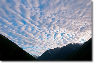
Weather Topic: What are Altocumulus Clouds?
Home - Education - Cloud Types - Altocumulus Clouds
 Next Topic: Altostratus Clouds
Similar to cirrocumulus clouds, altocumulus clouds are
characterized by cloud patches. They are distinguished by larger cloudlets
than cirrocumulus clouds but are still smaller than stratocumulus clouds.
Altocumulus clouds most commonly form in middle altitudes (between 2 and 5 km)
and may resemble, at times, the shape of a flying saucer.
These uncommon formations, called altocumulus lenticularis, are created by uplift
in the atmosphere and are most often seen in close proximity to mountains.
Next Topic: Altostratus Clouds
Current conditions powered by WeatherAPI.com


