Weather Alert in Alaska
Winter Storm Warning issued February 21 at 11:21AM AKST until February 22 at 3:00PM AKST by NWS Fairbanks AK
AREAS AFFECTED: Lower Kobuk Valley; Northern Seward Peninsula
DESCRIPTION: * WHAT...Heavy snow and periods of wintry mix expected. Winds gusting as high as 40 mph. Visibility may be reduced to a half mile or less at times. Total snow accumulations between 8 and 15 inches and ice accumulations around a light glaze. * WHERE...Lower Kobuk Valley and Northern Seward Peninsula. * WHEN...Until 3 PM AKST Sunday. * IMPACTS...Travel could be very difficult. Areas of blowing snow could significantly reduce visibility to 1/2 mile or less at times. * ADDITIONAL DETAILS...Winds weaken Sunday morning allowing conditions to improve, but showery snowfall continues through Sunday into early Monday. Warming temperatures late Saturday into early Sunday leads to periods of wintry mix and improved visibilities.
INSTRUCTION: Travel should be delayed if possible. If you must travel, keep an extra flashlight, food, and water in your vehicle in case of an emergency.
Want more detail? Get the Complete 7 Day and Night Detailed Forecast!
Current U.S. National Radar--Current
The Current National Weather Radar is shown below with a UTC Time (subtract 5 hours from UTC to get Eastern Time).

National Weather Forecast--Current
The Current National Weather Forecast and National Weather Map are shown below.

National Weather Forecast for Tomorrow
Tomorrow National Weather Forecast and Tomorrow National Weather Map are show below.

North America Water Vapor (Moisture)
This map shows recent moisture content over North America. Bright and colored areas show high moisture (ie, clouds); brown indicates very little moisture present; black indicates no moisture.

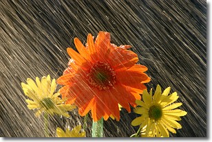
Weather Topic: What is Rain?
Home - Education - Precipitation - Rain
 Next Topic: Shelf Clouds
Precipitation in the form of water droplets is called rain.
Rain generally has a tendency to fall with less intensity over a greater period
of time, and when rainfall is more severe it is usually less sustained.
Rain is the most common form of precipitation and happens with greater frequency
depending on the season and regional influences. Cities have been shown to have
an observable effect on rainfall, due to an effect called the urban heat island.
Compared to upwind, monthly rainfall between twenty and forty miles downwind of
cities is 30% greater.
Next Topic: Shelf Clouds
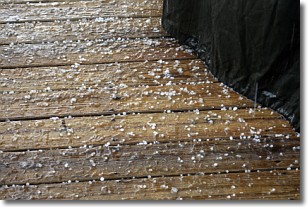
Weather Topic: What is Sleet?
Home - Education - Precipitation - Sleet
 Next Topic: Snow
Sleet is a form of precipitation in which small ice pellets are the primary
components. These ice pellets are smaller and more translucent than hailstones,
and harder than graupel. Sleet is caused by specific atmospheric conditions and
therefore typically doesn't last for extended periods of time.
The condition which leads to sleet formation requires a warmer body of air to be
wedged in between two sub-freezing bodies of air. When snow falls through a warmer
layer of air it melts, and as it falls through the next sub-freezing body of air
it freezes again, forming ice pellets known as sleet. In some cases, water
droplets don't have time to freeze before reaching the surface and the result is
freezing rain.
Next Topic: Snow
Current conditions powered by WeatherAPI.com


