Weather Alert in New York
Winter Storm Watch issued February 22 at 12:26AM EST until February 24 at 4:00AM EST by NWS Buffalo NY
AREAS AFFECTED: Chautauqua
DESCRIPTION: * WHAT...Heavy lake enhanced snow possible. Potential for 7 inches or more of accumulation. * WHERE...Chautauqua County. Greatest snow accumulation will be found upon the Chautauqua Ridge axis. * WHEN...From this evening through late Monday night. * IMPACTS...Travel could be difficult. The hazardous conditions could impact the Monday morning and evening commutes. * ADDITIONAL DETAILS...Light snow today and this early evening across the county, transitioning to heavy snow tonight through Monday night, with the focus upon the upslope Chautauqua Ridge axis for greatest accumulations.
INSTRUCTION: Narrow bands of heavy snow could bring rapidly changing road conditions and visibilities. Localized travel problems will be possible.
Want more detail? Get the Complete 7 Day and Night Detailed Forecast!
Current U.S. National Radar--Current
The Current National Weather Radar is shown below with a UTC Time (subtract 5 hours from UTC to get Eastern Time).

National Weather Forecast--Current
The Current National Weather Forecast and National Weather Map are shown below.

National Weather Forecast for Tomorrow
Tomorrow National Weather Forecast and Tomorrow National Weather Map are show below.

North America Water Vapor (Moisture)
This map shows recent moisture content over North America. Bright and colored areas show high moisture (ie, clouds); brown indicates very little moisture present; black indicates no moisture.

Weather Topic: What is Precipitation?
Home - Education - Precipitation - Precipitation
 Next Topic: Rain
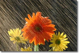
Precipitation can refer to many different forms of water that
may fall from clouds. Precipitation occurs after a cloud has become saturated to
the point where its water particles are more dense than the air below the cloud.
In most cases, precipitation will reach the ground, but it is not uncommon for
precipitation to evaporate before it reaches the earth's surface.
When precipitation evaporates before it contacts the ground it is called Virga.
Graupel, hail, sleet, rain, drizzle, and snow are forms of precipitation, but fog
and mist are not considered precipitation because the water vapor which
constitutes them isn't dense enough to fall to the ground.
Next Topic: Rain
Weather Topic: What are Shelf Clouds?
Home - Education - Cloud Types - Shelf Clouds
 Next Topic: Sleet
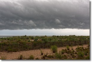
A shelf cloud is similar to a wall cloud, but forms at the front
of a storm cloud, instead of at the rear, where wall clouds form.
A shelf cloud is caused by a series of events set into motion by the advancing
storm; first, cool air settles along the ground where precipitation has just fallen.
As the cool air is brought in, the warmer air is displaced, and rises above it,
because it is less dense. When the warmer air reaches the bottom of the storm cloud,
it begins to cool again, and the resulting condensation is a visible shelf cloud.
Next Topic: Sleet
Current conditions powered by WeatherAPI.com


